The problem of cloud cover
Cloud Interference in Remote Sensing
Cloud cover is a challenge optical remote sensing, period. When working with optical data, you will encounter clouds, sometimes more in some places or periods than in others. But how can you identify the impact of this interference in your study?
For agricultural purposes, Dr. Alyssa K. Whitcraft has published some interesting papers. One of them is this paper in Remote Sensing of Environment. The research underscores the need to consider cloud impacts when planning future Earth observation missions with agricultural monitoring objectives. The study used 10–13 years of MODIS (worldwide) data and reveals that frequent and pervasive cloud cover during key agricultural seasons often limits clear views.
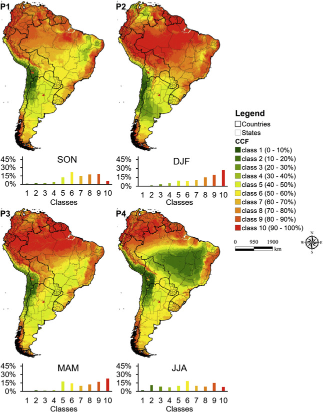
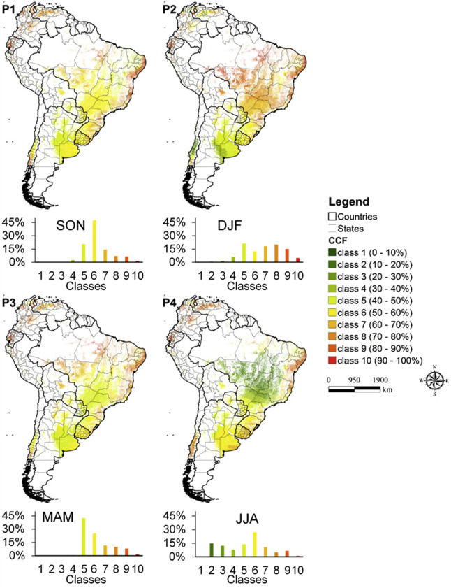
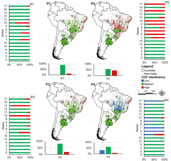
If you’re studying South America, I have led this paper in Remote Sensing Applications: Society and Environment. Our research showed that cloud cover frequency (CCF) can limit the use of optical remote sensing in South America, especially during rainy seasons. Our study examined 15 years of MODIS data to assess monthly CCF in South America and its impact on agricultural monitoring. Results show that cloud cover varies with geographic location and crop season, affecting optical remote sensing of major crops like soybeans and maize. For example, from December to February (P2 period), 70% to 80% cloud cover was common, making ORS challenging in states like Mato Grosso, Goias, Bahia, Tocantins, and Parana. To address this limitation, we can improve the frequency of Earth observation by combining multi-sensors (including microwave and optical sensors), allowing more accurate agricultural monitoring despite cloud cover challenges.


You can consult the monthly CCF in the Google Earth Engine app below. The data can be retrieved at the pixel or state level.
Example of use
Enjoy Reading This Article?
Here are some more articles you might like to read next: